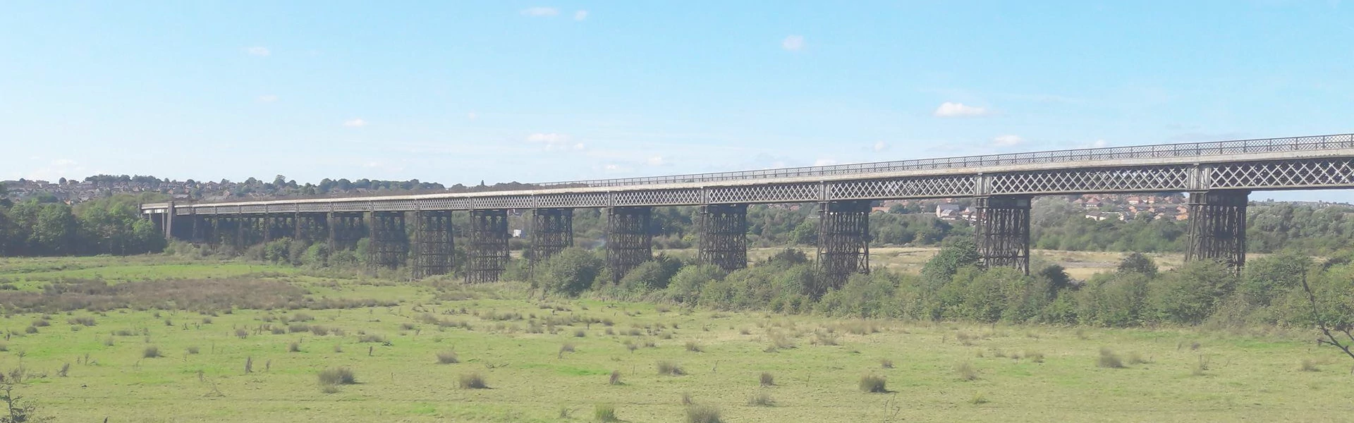
Location
The viaduct is situated between Cotmanhay and Awsworth, at Ordnance Survey grid reference SK 473 438. There is now public access on the viaduct itself and it may be viewed from the nearby footpaths and trails.
The viaduct is now a cycling and walking route and is approached on foot or cycle. Details of footpaths and trails around the site can be seen here. Footpaths and trails. You can also find information about cycling and walking trails in the area on the Visit Peak District and Derbyshire website.
There is very limited parking in the immediate area itself, but many ways of walking and cycling to the viaduct and accessing it via public transport.
You can now access the viaduct deck by wheelchair, mobility scooter or with a buggy from both Erewash/Derbyshire and Broxtowe/Nottinghamshire sides.
Coming by Car
Special parking is provided on event days only in a compound underneath the viaduct. Access via Newton’s Lane off Awsworth Road (what3words reference: ///played.reds.whites). If you are coming from Nottingham (A6096, Shilo Way) turn RIGHT onto Newton’s Lane then turn RIGHT again just before the railway bridge. If you are coming from Ilkeston, it is your first LEFT after the railway bridge. It can be tricky navigating this road as digital map systems show Newton’s Lane as Awsworth Road, we highly recommend using what3words for your journey. The gate to the lane will be open. Drive down the tarmac lane until you arrive underneath the viaduct. Volunteers will be on hand to direct parking. If you are walking to us, use the towpath of the Erewash canal through the woodland track, cross the railway footbridge and follow the path to the compound.
You can also park at Ilkeston train station Car Park (small charge) with a 15-20 minute walk to the viaduct described here. This is through lovely countryside and has great views of the viaduct.
There is on-street parking in Awsworth (cross the bypass carefully) and on Bridge Street and Stratford Street via Trueman Street in Cotmanhay. If parking on the street please be considerate to residents.
There is a very small car park beside the Nottingham Canal off Newton’s Lane at grid reference SK 476 433. Anyone wishing to park here should be aware that it is not a dedicated car park and is used by anglers and canal users. The Nottingham Canal tow-path and the Erewash Valley Trail also pass this point. You can then reach the viaduct on foot as described here.
Coming by Train
Ilkeston train station is the closest to Bennerley Viaduct being only 1 mile/ 1.6km away. The Nottingham Canal path and Erewash Canal towpath (both parts of the Erewash Valley Trail) are just a short walk or cycle from the station. The directions via Google maps can be found here, Langley Mill train station lies 3 miles/ 5km north. From here it’s a pleasant ride south on the Erewash Valley Trail to the Bennerley area. Long Eaton train station lies 8 miles/13km to the south from where it’s an excellent ride north along the Erewash Canal towpath to Bennerley.
Visit: www.nationalrail.co.uk for train times.
Coming by Bus
From Nottingham catch Trent Barton’s ‘The Two’ to Bridge Street, Cotmanhay from where it is a short walk to the Erewash Canal.
From Derby catch Trent Barton’s ‘Ilkeston Flyer’ to Bridge Street, Cotmanhay from where it is a short walk to the Erewash Canal. Both services pass through Ilkeston town centre, home of the Erewash Museum.
The Trent Barton service 27 between Kimberley and Ilkeston stops in Awsworth. Get off opposite Main Street (Ilkeston to Kimberley direction). Walk along Meadow Road and through the “Pocket Park” to Shilo Way. Cross Shilo Way to the eastern end of the viaduct. Travelling from Kimberley towards Ilkeston get off adjacent to Main Street, cross the road and follow the previous directions. Service 27 also stops at Ilkeston train station.
Timetables
The Two (Trentbarton)
Ilkeston Flyer (Trentbarton)
21 (Trentbarton)
27 (Trentbarton)